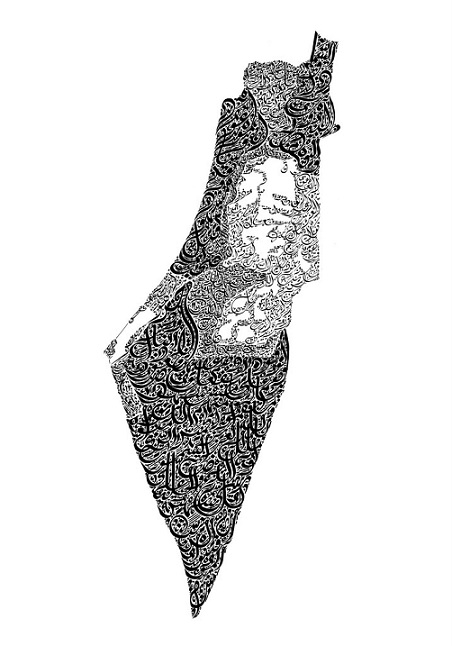
The map of Palestine is depicted showing the different borders as they have changed over time. The darkest area represents land which was given to Israel by the United Nations in 1948, the slightly less dark areas represent land captured by Israel in the war immediately following its creation. The lightest grey areas represent land which Israel has illegally settled since the war of 1967 when it invaded neighboring countries, Syria, Jordan and Egypt. The white areas represent land which the remaining Palestinian Arab population is allowed work and live in.
The text for this piece is Surah 85: Al-Buruj written exactly once, starting in the darkest area read from top to bottom, and then continuing continuing in the lighter text, and finally finishing in the lightest areas, representing the post 1967 settled land.